Map
Vessels
Photos
Ports
Containers
News
Services
Paid
Plans & Prices
RealTime AIS Data
Historical AIS Data
Container Tracking
Free
News
Mobile Apps
Route Planner
Fleet Explorer
Embed map
Become AIS Partner
Contact us
Recent searches
✕
Clear History
Standard map
Simple map
Dark map
Satellite map
Nautical charts
Off
Temperature
Wind Speed
Waves
+
–
1 NM
Lat:
41.28365
Lon:
13.25506
41° 17.019′
13° 15.304′
i
©
OSM
contributors.
Show My Fleets
Hide Satellite positions
Measure Distance
Refresh map
Show My Fleets
Hide Satellite positions
Measure Distance
Refresh map
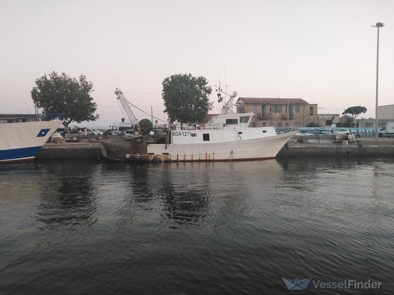
CARLOPADRE
Fishing vessel
Details
Track
Add photo
Add to fleet
Destination
Destination not available
ETA: -
Speed:
0.0 kn
Course:
0°
Draught:
-
Status:
Fishing
Last report:
Apr 02, 2025 14:55 UTC
Last Port
Terracina, Italy
ATD: Apr 01, 23:23 UTC
(18 hours ago)
Port Calls
Weather
Vessel Particulars
Gross Tonnage:
-
Built:
-
IMO:
-
Deadweight:
-
Size:
22 / 6m
MMSI:
247092230