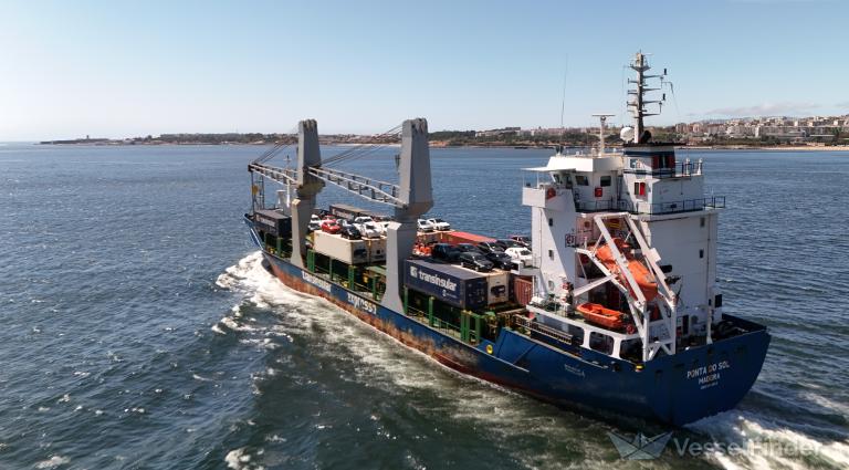
Map
Vessels
Photos
Ports
Containers
News
Services
Paid
Plans & Prices
RealTime AIS Data
Historical AIS Data
Container Tracking
Free
News
Mobile Apps
Route Planner
Fleet Explorer
Embed map
Become AIS Partner
Contact us
Recent searches
✕
Clear History
Standard map
Simple map
Dark map
Satellite map
Nautical charts
Off
Temperature
Wind Speed
Waves
+
–
50 NM
i
©
OSM
contributors.
Show My Fleets
Hide Satellite positions
Measure Distance
Refresh map
Show My Fleets
Hide Satellite positions
Measure Distance
Refresh map
PONTA DO SOL
General Cargo Ship
Details
Track
Add photo
Add to fleet
Destination
ETA: -
Speed:
13.8 kn
Course:
211°
Draught:
6.4 m (max 6.4)
Status:
-
Last report:
Mar 27, 2025 13:38 UTC
Last Port
Track for
$20 / month
Satellite position: 23 min ago
Port Calls
Weather
Vessel Particulars
Gross Tonnage:
4115
Built:
1997
IMO:
9141613
Deadweight:
5184
Size:
101 / 16m
MMSI:
255806012